Asheville cartographer puts Western North Carolina on the map

Photo by Colby Rabon
Name any trail in Western North Carolina and chances are Pete Kennedy has hiked, biked, or run it at least once. Putting boots (or, in some cases, tires) on the ground is a key part of his job as the founder of Pisgah Map Company, an Asheville-based business that makes paper maps of regional recreation areas.
“We call it ground-truthing,” Kennedy says. “You can download tons of data from counties, states, and the U.S. Forest Service and throw it on a map, but you have to get out there and see how accurate all that data is.”
Kennedy has been “getting out there” since his teenage years when he moved from Hartsville, South Carolina, to the mountains to attend Asheville School. During his freshman year, he and some classmates went on a multi-day backpacking trip in the Linville Gorge Wilderness. It was Kennedy’s first experience in the woods, and it rained the whole time. But he loved it.
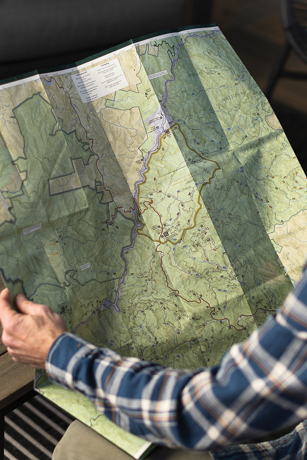
Photo by Colby Rabon
After graduating, Kennedy followed his passion for the outdoors to Clemson University, where he pursued an undergraduate degree in recreation resource management and a graduate degree in forestry. As part of his studies, he became well-versed in geographic information systems — a powerful data-analytics tool that allows users to map all sorts of information like disease outbreaks, municipal water lines, and highway traffic.
“You can use GIS to notice patterns in the world around you that you wouldn’t otherwise notice,” says Kennedy. You can also use it to create top-tier trail maps. Kennedy made this realization back in 2009.
By that point, he had spent the better part of two decades relying on other people’s maps of WNC to get him from point A to point B. Knowing he could do better, he began charting the Pisgah Ranger District.
Finishing that first map took him a full year. (He was and still is a GIS instructor at Asheville-Buncombe Technical Community College by day.) But as soon as it hit the printer, outfitters like Diamond Brand, Frugal Backpacker, and even REI joined the growing list of stockists.
“The map was really well received,” says Kennedy, who has since released about a dozen maps of beloved places like DuPont State Recreational Forest, Hickory Nut Gorge, and the Green River Game Lands.
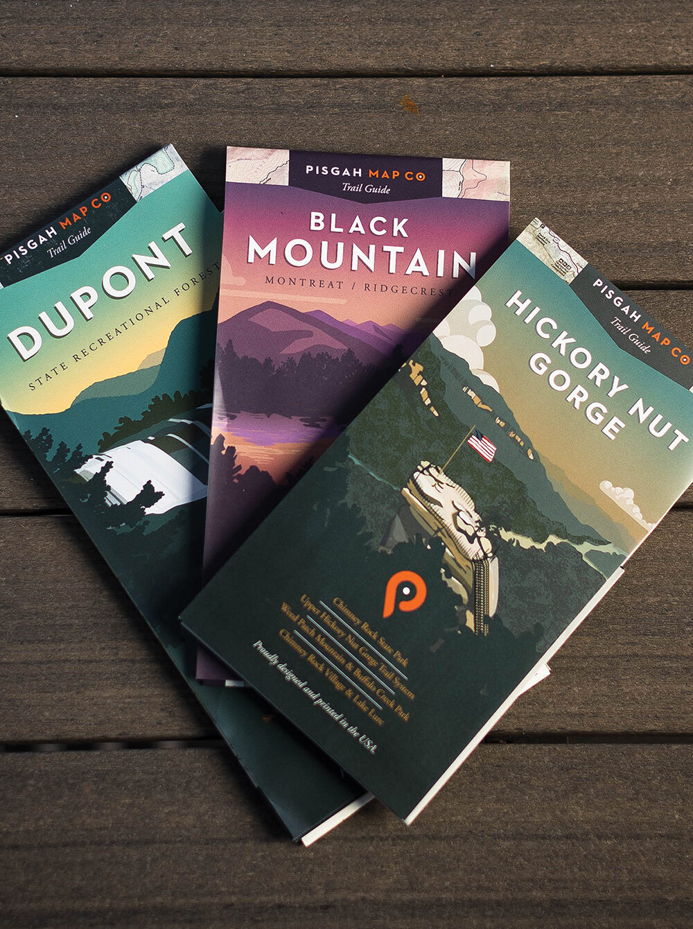
Photo by Colby Rabon
According to Kennedy, his maps are the best on the market for a number of reasons. First off, they’re timely. “You’re not going to find a map that’s more current. We work with land managers to update them every year,” he reveals.
Pisgah Map Company’s products are also nice to look at. Kennedy thinks a lot about graphic-design elements like fonts and color palettes. He even commissions his neighbor, Jim Slatton, to hand sketch the covers.
Needless to say, map making is a “labor of love.” And, yes, Kennedy is aware that there are hundreds of navigation apps out there like AllTrails and Avenza. But unfolding a paper map is a “purist thing,” he says.
“Opening up a map and stretching it out in front of you gives you such a better sense of place,” says Kennedy. “It connects you to an area much more than a little blue dot on your phone.”
Pisgah Map Company, Asheville. For more information, including a list of local stockists, visit pisgahmapcompany.com.